I hiked Mt. Si with my husband and friends back in 1999 (yep, 10 years ago) and it was a hard hike for me then. Not only was I in “below average” cardiovascular shape for a 26 year old, but I just wasn’t prepared for the stamina it would take to make relentless uphill switchbacks for almost 4 miles straight. The accumulative gain is 3,900 feet and is a pyramid shaped hike, meaning straight up and straight down. There are no meandering fields and flat spots, except for Snag Flats, which comes at the 1.8 mile mark, and is a brief respite.
What was impressive to me was the broad range of types this mountain draws. Although much easier hikes can be found, the popularity of Mt. Si brings folks from all walks (and all levels of preparedness). Some folks appeared to be out for a day of shopping, but ended up on the mountain somehow. Others were geared with heavy packs and poles, ready for anything. There are lots of dogs that make the brave trek up to the top, and some you wouldn’t expect. While the scores of retrievers are a given, there were quite a few small dogs huffing and puffing their way up… Dachshunds, Chihuahuas, Jack Russells, etc. I would never do that to pampered Polli. 100 yards and she’d be asking for a treat and glass of water for her efforts(yes, a glass. My dog drinks out of a people glass!).
Aside from dogs, there were a lot of kids. From babies in back carriers to older kids (6+), people were towing tots up that thing…not always to the top, but there were a handful up there when I finally arrived. Good for those parents setting a good example to their kids. Good for those kids doing it with very little complaint (that I heard).
I saw a couple on a first date (poor guy trying to be macho and not look like he was dying). I saw scores of Seniors (meaning 65+), some breezing past me effortlessly. One man was 80 if he was a day. He was at least 10-15 years older than my own dad…if not more. I remember thinking that he was going at such a slow pace, he’d never make it…sure he’d stop at Snag Flats and turn around. Nope. He was wearing a good sized pack and shuffling along like a Carol Burnett character, but did not pull out a bottle of water a single time, and never stopped once that I saw. Adding up the approx. quarterly mile stops I made, I only made it to the top about 20 minutes faster than him. He didn’t take a sideways glance at the view, but continued up to the haystack. In the end, he was just getting to the parking lot as I drove out. I was humbled beyond belief by that man and I wish I would have stopped him for a picture.
I was not entirely alone. I did meet a group of about 14 people, but everyone had different starting/stopping needs, so everyone was on their own pace by about 1 mile. I struck up a few conversations, but the reason for me was the hike and I’m not much of a chatter while I exercise. Some more sprawling hikes will be better for leisurely chat while we ascent, but not this one. I needed to concentrate on not dying. I did meet nice folks once up at the top though, and I’m glad I joined a group rather than going it alone.
The last half mile or so is a real killer. Just when it feels like it can’t get any steeper, the tree cover dissipates and the floor cover turns to pure rock. The boulder climb is a real test at the end, but opens to a big rocky opening with sweeping Southeastern views of North Bend and the summits of other wilderness peaks at the mouth of the Cascade mountain range. What’s really amazing is the view of Mt. Rainier from up there. It’s unobstructed (how can you obstruct the highest point in the state) top to bottom, and just literally glows in glory…because it has snow cover year round, it is a stark contrast to the now green foothills and the blue of yesterday’s sky. Pictures are cool, but there really is nothing like seeing it up close.
On the other side, a Westerly view displays the Snoqualmie Valley and Puget Sound basin in the far distance. There was just enough haze to keep me from getting good pics, but I was OK with that. They’re better than the pics I would have gotten if I hadn’t gone… that would be none.
The hike down was not as easy as I remember the last time. Eventhough tens of thousands of people pound this well groomed trail every year, it is still very rocky and root covered. My feet didn’t start hurting until the descent, and although I didn’t get any blisters, the balls of my feet felt bruised by the time I reached bottom. I also realized a fatal mistake… I drank way too much in an attempt to rehydrate at the top. I didn’t need it as much on the descent, and therefore quickly had to pee. There are no outhouses up there…and obviously none on the trail, so from about mile marker 3 and down, I had a very very full bladder. I was in pain by the time I reached my car. I was not about to use the outhouse at the trailhead, as I used it before heading up and had to hold my breath to keep from gagging. I am just not an outhouse girl. Call me girly, but I just can’t handle it. Smell aside, I’ve watched way too many horror movies. Bad guys and monsters hide in those things.
I made it home less than 20 minutes later and despite not really being able to feel my legs during the drive home, I have to say I recovered almost immediately. Slept fine through the night with no leg cramps, and only some residual hip/quad stiffness today. Dare I say I’m ready to go up again? Maybe it’ll be a monthly thing. Shame on me for not timing myself at each mile/elevation marker. I will have to do that next time.
This week: I plan to do a Wednesday afternoon hike with a ladies hiking group I joined, probably a Tiger Mountain trail…and then I am scheduled to do Rattlesnake Ridge on Sunday. This is Southwest of Mt. Si by a few miles and with it’s own set of great views. It’s another challenging hike and has some steep ledges, but we’re planning on going about it very conservatively. Just yesterday, a hiker went too far out on a ledge, lost his footing, and fell to his death. Tragic, but preventable.
From yesterday’s hike, I learned some do’s and don’ts that I hope I can take into my next hikes. More than anything, it was humbling. If I thought it was a tough 4 miles up with less than 10% of my body weight on my back, I can only imagine what a trek up Mt. Rainier would be like with dozens of miles ahead in any given leg, and almost ½ my body weight strapped to me….in the snow. I’ve got a lot to learn.
Do’s
-Bring a pack just big enough to carry the 10 Essentials and no bigger.
-Wear liner socks under hiking socks. They made a big difference in how my feet moved (or didn’t move) in my boots
-Get good trail sunglasses. My designer numbers were a total pain and finally found their way deep in my pack.
-Clip a towel to my pack. I bought a medium sized shammy towel from REI and it was a lifesaver. I used it to wipe my nose, kept sunscreen from running in my eyes, and wiped sweat off my neck. It was a good $10 investment.
-Have some way to have water hands free. Whether that be a Camelbak apparatus or just a way to clip my bottle to my pack, the only battle scar I came away with was a hot spot on my index finger from carrying my water bottle the entire freaking time.
-Have a wrist loop for my camera. I dropped my camera on the trail and broke off a non-essential piece…but it made a loud shatter noise and scared me to death. It could have been much worse.
-Make an effort to meet new people. I’m horrible at this, but it made the hike more enjoyable, even if most of us hiked it independently after mile 1 or 1. 5.
-Feel great about the older folks making the effort. That old guy I mentioned is a hero in my book, and I know there are many many others just like him (such as my own dad) that shatter the “retire, then die” stereotype.
Don’ts
-Use a cell phone. I was shocked at the number of people hiking deep into that hillside with a cell phone at their ear. Unless it’s with 911 for a ride out, I think they should be outlawed on the trails. I want to get away from technology (beyond maybe a GPS) when I’m out there… I’m thrilled that they get good reception, and I’m sure it’s a really cool iPhone App you’re using as a compass, but shut up and walk. The rest of us don’t really care about who’s nominated for Best Kiss at the MTV Movie awards.
-Drink a ton of water at the top. I was so intent on getting electrolytes back in my system that I forgot the liquids were no longer going to be sweating out of me. I had to pee the worst ever ¼ of the way down…and was not going to go off trail to do it. Leading to the next one…
-Pack a portable role of biodegradable TP. See the previous Don’t…just in case I’m on a much longer trail and don’t have a choice.
-Ignore right of way rules. There were a couple of times I was almost taken over the side by people with a gaggle of kids, dogs, and poles. Granted, I can see how momentum coming down makes it hard to just stop for oncoming traffic.
-Get there any later than 8am on a weekend. I arrived at 8:30 and the lot was already almost full…and it’s a very big lot. There were already tons of people coming down and not as many going up at that point. When I arrived back at my car, there were “pretend” parking spots popping up everywhere, making it hard to get out. I’ll never do a mid-day Si hike on a Sat or Sun. That’s for sure.
-Assume I’m fit for these hikes. I need much better cardio (and at steep intervals) if I’m going to take this seriously.
Below are a slew of pics from the hike. Most are from the top since it just isn’t feasible to stop and pull out my camera along the trail. It also felt a lot like my backyard growing up, so much of the forest section was ho-hum for me. I’m sure it’s the same for the folks who live in Downtown Rome and have to stare at ruins/monuments all day long every day. It’s just not as awe inspiring as it is to the tourists.
When looking at the incline in these pictures, I have to point out that it was MUCH steeper. The pics of The Great Wall in China were much the same….Much, much, much steeper and uneven than pictures could ever indicate.
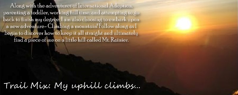
I've also included a little bio of the mountain for those not from around here.
Mount Si (pronounced sigh) is a small mountain in the U.S. state of Washington. Although just 4,167 ft (1,270 m) high, it lies on the western margin of the Cascade Range just above the coastal plains around Puget Sound, and towers over the nearby town of North Bend. The mountain was named after local homesteader Josiah "Uncle Si" Merritt. It was made famous in the show Twin Peaks, which was filmed in North Bend.
Only about a 45-minute drive from Seattle, the mountain is a favorite outdoor destination for Puget Sound locals. On most summer days one can count numerous hikers on the trail to the summit. Mount Si gets between 80,000-100,000 hikers annually.
The trail climbs 3,200 ft (3,500 ft including the "Haystack") in about 4 miles (6.4 km), making it an ideal conditioning trip, and it is open during the winter and spring when most of the Cascades are snowed in. Hikers wanting extra exercise will carry up jugs of water in backpacks, then empty them at the top so as to reduce knee stress on the walk down.

View of the mountain from the valley


 This was the older man who, in my opinion, kicked everyone's butts. I hope I'm still this capable 40 or 50 years from now!

 From the 3.5 mile marker. I-90 and the opening to Snoqualmie Pass
 This gal was with her teenaged grandkids. She said she's hiked this hill so many times, she's lost count. You go, Granny!
 The rocky last few steps
 The endpoint for some... for others, just a resting spot.
 The mountain and unique cloud formations were worth it
 Another view of North Bend and I-90
Me with Mt. Rainier in the background (looks so much smaller than it really was)
 More Rainier
 And then a little more
 I did not go up to the Haystack, but it's a rock scramble to the top for a little more view. I did get pics of the Snoqualmie Valley view, though:
 This woman probably wouldn't have done this if she knew a man had fallen a on Rattlesnake Ridge ledge (maybe right around the same time)
 Me with Snoqualmie in the background
 My neighborhood (look for the golf course, then up and to the left just a bit)
 Hard to see thru the haze, but Seattle is in the far distance, then the Olympics
 A rock formation just across the way
Another view of the valley
 A gal from our group climbed out pretty far to meditate. I hope she has good equilibrium!
My car is so perfect for hiking.

